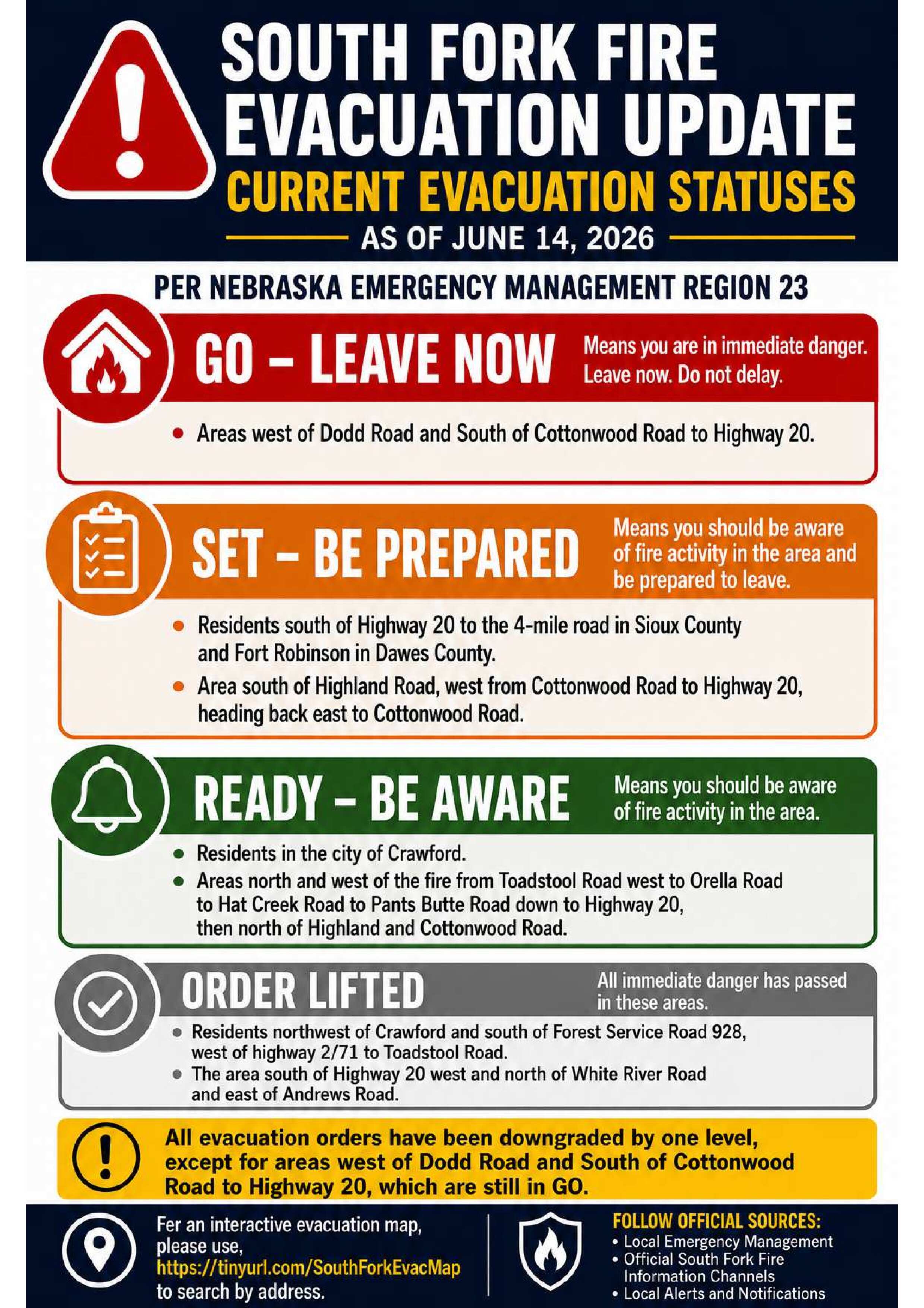
South Fork Fire Evacuation Status Update: June 14, 2026
RELEASE DATE: Jun 14, 2026
As noted in the Daily Update, this will serve as today's evacuation status update.
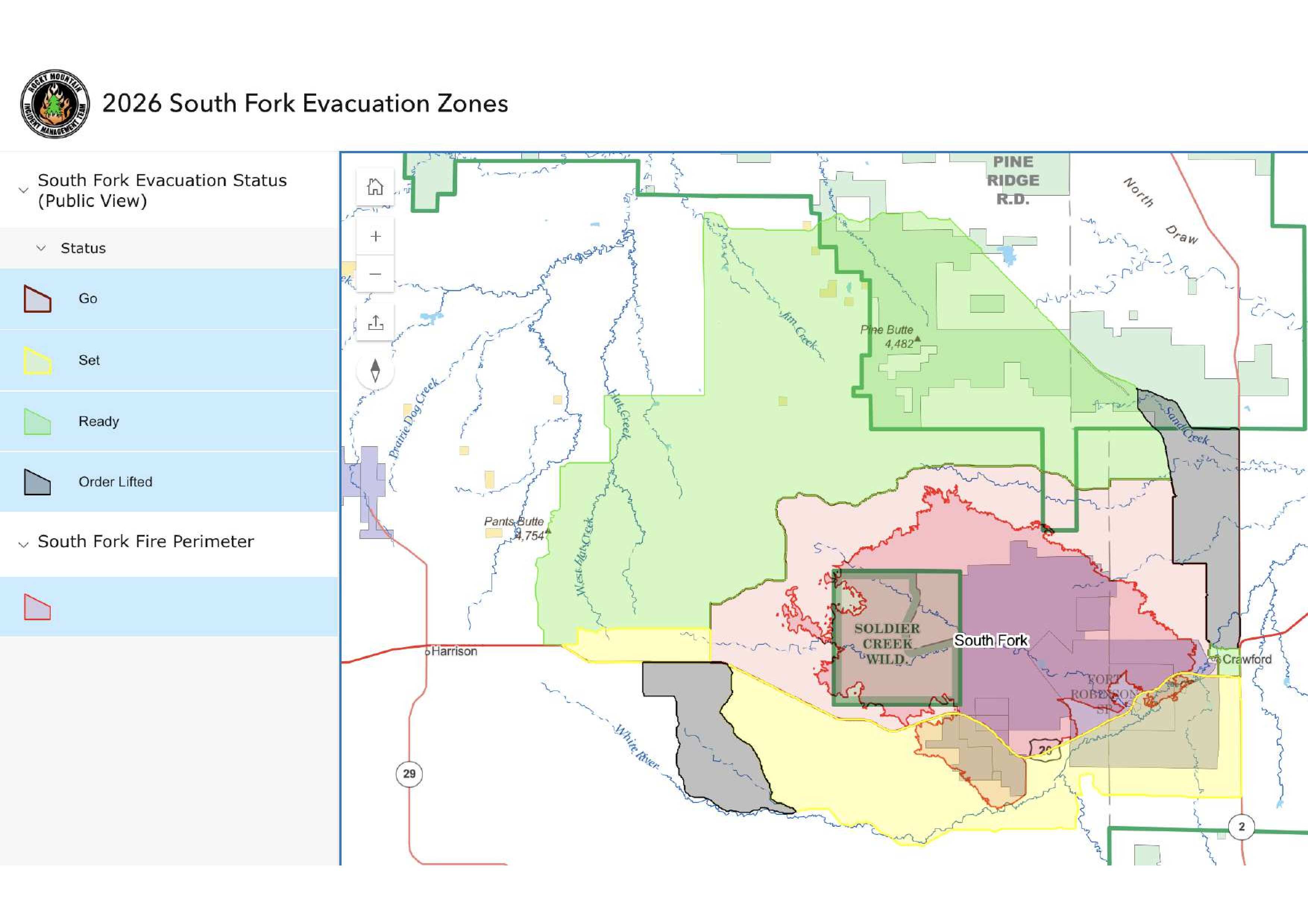
Please find attached the current Evacuation Flyer, Map, and here is the link for the South Fork Fire Interactive Evacuation Map, https://tinyurl.com/SouthForkEvacMap.
Any new evacuation orders or changes that increase an area's evacuation level will be communicated separately as they occur. Please review the current evacuation statuses below and be prepared to take the appropriate actions for your area.
*As of this morning, some areas have been downgraded one level.*
GO (Leave Now)
• Areas west of Dodd Road and south of Cottonwood Road to Highway 20
SET (Be Prepared to Leave)
• Residents south of Highway 20 to 4 Mile Road in Sioux County and Fort Robinson in Dawes County
• Area south of Highland Road, west from Cottonwood Road to Highway 20, then back east to Cottonwood Road
READY (Be Ready)
• Residents within the City of Crawford
• Areas north and west of the fire from Toadstool Road west to Orella Road, to Hat Creek Road, to Pants Butte Road, south to Highway 20, and north of Highland and Cottonwood Roads
EVACUATION ORDERS LIFTED
• Residents northwest of Crawford and south of Forest Service Road 928, west of Highway 2/71 to Toadstool Road
• The area south of Highway 20, west and north of White River Road, and east of Andrews Road
As conditions continue to change, residents are encouraged to stay alert, monitor official information sources, and be prepared to take action if evacuation statuses change. For address specific evacuation status and maps, please use the South Fork Fire Interactive Evacuation Map, https://tinyurl.com/SouthForkEvacMap.